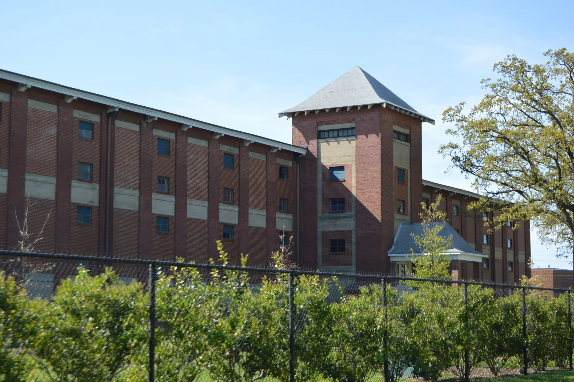
Southwest High Point covers Southside, Highland Mill Village and Oak Hill south of downtown, in ZIP code 27260, zoned for Ferndale Middle and Central High.
Last checked Oct. 11, 2026. Sources: the Southwest Renewal Foundation’s Blueprints for Southwest High Point (PDF), the City of High Point’s Southwest Mill District Area Plan (PDF), Core City Plan (PDF), neighborhood associations page and parks pages, Guilford County Schools’ School Assignment Locator, the N.C. Department of Public Instruction’s 2025-26 accountability data, Guilford County address points and Zillow Research.
Southwest High Point is the quadrant just south of downtown that the Blueprints for Southwest High Point define: downtown to the north, South Main Street to the east, West High Avenue and the railroad to the west, and Richland Creek and West Market Center Drive to the south, 535 acres of industry, shops, homes and the Heritage Greenway. Its neighborhoods, named in the city’s Core City Plan, are Southside, Highland Mill Village and Oak Hill. Most homes are in ZIP code 27260.
What this means for you
- Zoned high school: High Point Central High, 44.8% of state tests at grade level in 2025-26. Check an address with the district’s School Assignment Locator.
- Home value: $141,075 in ZIP code 27260 in August 2026, according to the Zillow Home Value Index.
- Nearest freeway access: Business 85 (US 29/70) at Surrett Drive, about 2.2 miles by road.
Part of our High Point neighborhoods guide.
Where it is
The Core City Plan places the three neighborhoods this way:
- Southside, “generally east of West Green Drive and west of South Elm Street,” reaching north past Taylor Avenue toward the rail yard.
- Highland Mill Village, east of West Green Drive, north of West Market Center Drive, west of South Elm Street and south of the railroad, built as housing for workers at the Highland Yarn Mill.
- Oak Hill, in the Core City’s southwest corner, with Oak Hill Elementary as its anchor and a small commercial hub at West Ward Avenue and Prospect Street.
The city council adopted the Southwest Mill District Area Plan on March 24, 2025, to guide the reuse of the old mill buildings and new building around the 300 Oak Street block, which the city’s 2045 plan names a town center. The former Pickett Cotton Mills, 1200 Redding Drive, is inside the quadrant. The Southside and Highland Mills neighborhood associations are on the city’s association list.
All but one of the 3,660 Guilford County address points in the area are inside the city; 78% carry ZIP code 27260 and 22% 27262. Downtown is to the north, the West End to the northwest and Macedonia to the east, across South Main Street.
Schools
The area is in Guilford County Schools. On the district’s 2026-27 attendance-zone map, the one behind its School Assignment Locator, all but two of the county’s address points were zoned for Ferndale Middle and High Point Central High. Elementary zones split: 40% Oak Hill Elementary, 31% Northwood Elementary on the north side and 29% Fairview Elementary in Southside.
Scores are the share of state tests at grade level or above in 2025-26 and the state’s growth rating, from the accountability data.
| Level | School | At grade level | Growth |
|---|---|---|---|
| Elementary | Oak Hill Elementary, 320 Wrightenberry St. | 28.8% | Not met |
| Elementary | Northwood Elementary, 818 W. Lexington Ave. | 40.5% | Met |
| Elementary | Fairview Elementary, 608 Fairview St. | 36.3% | Not met |
| Middle | Ferndale Middle, 701 Ferndale Blvd. | 43.3% | Exceeded |
| High | High Point Central High, 801 Ferndale Blvd. | 44.8% | Met |
The Middle College at GTCC-High Point, a choice school, is at 901 S. Main St. on the quadrant’s east side. More in our schools guide.
Home values
The Zillow Home Value Index is a modeled typical value for the middle third of homes, not a sale price. Zillow publishes no figure for these neighborhoods.
| Area | August 2026 | August 2025 | Change |
|---|---|---|---|
| ZIP code 27260 | $141,075 | $144,587 | -2.4% |
| ZIP code 27262 | $213,070 | $213,516 | -0.2% |
| City of High Point, for comparison | $250,100 | $249,924 | +0.1% |
Both ZIP codes reach well beyond the quadrant. Trends are on our home prices page.
Parks and trails
From the city’s community parks and Southside Recreation Center pages:
- Southside Recreation Center and Park, 401 Taylor Ave., 336-883-3504: gym, fitness center, splash pad, walking trail, courts and picnic shelters; open 9 a.m. to 8 p.m. Monday to Thursday, 9 a.m. to 6 p.m. Friday and 9 a.m. to 2 p.m. Saturday.
- Goldston Park, 1302 S. Elm St.: playground, basketball court and picnic tables.
- Harvell Park, 1215 Lincoln Drive: lighted ball field, basketball court, playground and a cricket ground.
The Blueprints center the area’s future on the Heritage Greenway. More in our parks and trails guide.
Getting around
- Buses: High Point Transit’s Route 12 runs along West Green Drive, with stops at Vail Avenue and Trinity Avenue; Route 20, Kearns Avenue, stops at Amos Street and Vail Avenue; and Route 11 runs down South Main Street to GTCC, according to the city’s route schedules.
- Freeways: Business 85 (US 29/70) at Surrett Drive is about 2.2 miles by road, and at Brentwood Street about 2.6 miles.
- Downtown High Point: about 1.5 miles by road to City Hall.
- Piedmont Triad International Airport: about 17 miles by road.
Distances were measured with the OSRM routing engine on OpenStreetMap roads from a point near Taylor Avenue. They are distances, not drive times.
Groceries and everyday stores
OpenStreetMap lists no supermarket inside the quadrant. The nearest are on Westchester Drive to the west, a Food Lion and a CVS Pharmacy in the 2200 block and Aye Say Asian Market in the 1600 block, and a Walmart Supercenter and an ALDI on South Main Street to the south.
Frequently asked questions
What is Southwest High Point?
The 535-acre quadrant south of downtown that the Southwest Renewal Foundation’s Blueprints for Southwest High Point define: downtown to the north, South Main Street to the east, West High Avenue and the railroad to the west, and Richland Creek and West Market Center Drive to the south. It includes the Southside, Highland Mill Village and Oak Hill neighborhoods.
What schools serve Southwest High Point?
Almost every county address point in the area is zoned for Ferndale Middle and High Point Central High on Guilford County Schools’ 2026-27 map. Elementary zones split among Oak Hill, Northwood and Fairview.
What is the Southwest Mill District?
An area plan the High Point City Council adopted March 24, 2025, to guide reuse of the old mill buildings and new building around the 300 Oak Street block and the Heritage Greenway.
What is the typical home value in Southwest High Point?
Most of the area is in ZIP code 27260, where the Zillow Home Value Index was $141,075 in August 2026, down 2.4% from August 2025. The northwest edge is in 27262, at $213,070.
Have your say