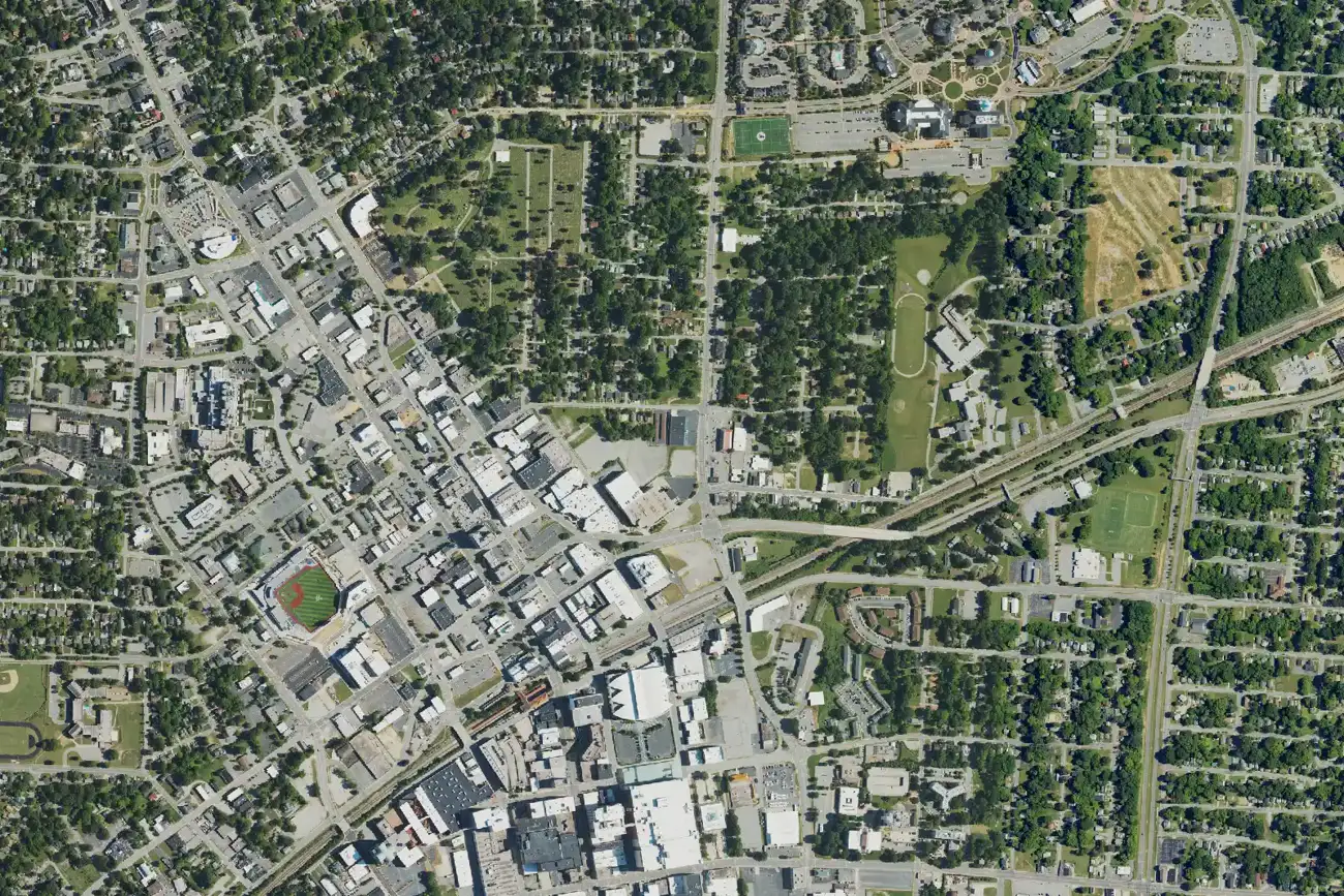
Eleven High Point areas compared: ZIP code, zoned high school and typical home value. School zones and mailing addresses do not follow the city limits.
Last checked Oct. 11, 2026. Sources: the City of High Point’s High Point 2045 Comprehensive Plan (PDF), Core City Plan (PDF), Northwest Area Plan (PDF) and neighborhood associations page, the Southwest Renewal Foundation’s Blueprints for Southwest High Point (PDF), OpenStreetMap place names, Guilford County Schools’ School Assignment Locator, the N.C. Department of Public Instruction’s 2025-26 accountability data, Guilford County address points, the U.S. Census Bureau’s QuickFacts and Zillow Research.
High Point is a city of 116,245 people, by the Census Bureau’s 2020-2024 American Community Survey estimates, with about 57.5 square miles of land inside its limits on the Census Bureau’s TIGERweb map. Most of it is in Guilford County, with smaller parts in Davidson, Forsyth and Randolph counties. Main Street runs north and south through downtown, I-74 (US 311) crosses the east side, Business 85 (US 29/70) and I-85 run along the south and I-40 passes the north end. The city’s High Point 2045 plan describes a city that grew north for 50 years, leaving its boundary “very ill-defined in the northern section,” with islands of city and county intermingled. Three facts shape where you live here more than any neighborhood name:
- Several ZIP codes, several markets. 27260 covers downtown and much of the center, south and east; 27262 the west and northwest of downtown; 27265 the north; 27263 the south toward Archdale. Zillow’s typical value in August 2026 was $141,075, $213,070, $302,306 and $227,841. Some homes inside the city carry Jamestown, Colfax or Greensboro mailing addresses.
- School zones do not follow the city line. Every address we checked in Guilford County is in Guilford County Schools, but the zones sent them to four different high schools, including Southern Guilford in Greensboro, and some blocks are in a choice zone. The parts of the city in Davidson, Forsyth and Randolph counties are served by those counties’ districts.
- City or county. A High Point mailing address can be in unincorporated Guilford County or in Archdale. That changes your tax bill, police and trash service.
What this means for you
- Look up any Guilford County address in the district’s School Assignment Locator or call GCS Student Assignment, 336-370-8303.
- Check whether a parcel is in the city with Guilford County’s real estate search.
- Zillow’s figures are a modeled typical value for the middle third of homes in a ZIP code, not a sale price.
The areas at a glance
High school is the one zoned for most of the county’s address points in the area; home value is the Zillow Home Value Index for the area’s main ZIP code in August 2026.
| Area | ZIP code | Zoned high school | Typical home value | Guide |
|---|---|---|---|---|
| Downtown | 27260 | Central High; Andrews on the east edge | $141,075 | Downtown |
| Emerywood | 27262 | Central High | $213,070 | Emerywood |
| Washington Street | 27260 | Andrews High; Central at the west end | $141,075 | Washington Street |
| West End | 27262 | Central High | $213,070 | West End |
| Southwest High Point | 27260, 27262 | Central High | $141,075 / $213,070 | Southwest |
| Macedonia | 27260 | Central High; east corner in the choice zone | $141,075 | Macedonia |
| Oakview | 27265 | Andrews or Central High | $302,306 | Oakview |
| Oak Hollow | 27265 | Andrews High; Central on the west side | $302,306 | Oak Hollow |
| Palladium area | 27265; some 27282, 27409 | Southwest Guilford or Andrews High | $302,306 | Palladium |
| Northwest | 27265, 27235 | Southwest Guilford High; Central in the south | $302,306 / $413,027 | Northwest |
| Allen Jay | 27263 | Southern Guilford High | $227,841 | Allen Jay |
In 2025-26, 44.8% of state tests at High Point Central High were at grade level or above, 42.9% at T. Wingate Andrews, 55.5% at Southwest Guilford and 52.3% at Southern Guilford, the state’s accountability data shows. Zillow’s typical value for the whole city was $250,100, up 0.1% from August 2025. More in our schools guide and home prices guide.
Map
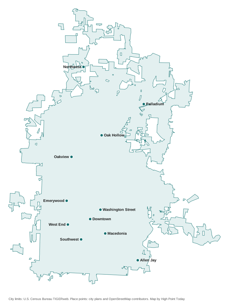
City limits from the U.S. Census Bureau’s TIGERweb; place points from the city’s plans and © OpenStreetMap contributors. The dots mark the middle of each area, not its boundaries.
The Core City: downtown and the older neighborhoods
The city’s 2007 Core City Plan covers the older city inside Eastchester Drive, the US 311 Bypass, Business 85 and Westchester Drive.
Downtown. City Hall, the Market showrooms, the Broad Avenue bus terminal and the Amtrak station, with Truist Point and Congdon Yards.
Emerywood. The neighborhood between Lexington Avenue and Chestnut Drive northwest of downtown, with the Uptowne shops at Lexington and North Main.
Washington Street. A local historic district since 2023 east of downtown, with Penn-Griffin Schools and the Morehead Recreation Center.
West End. West English Road and Kivett Drive west of downtown, around the Ferndale Middle and Central High campus and West End Park.
Southwest High Point. Southside, Highland Mill Village and Oak Hill, the 535-acre quadrant the city’s Southwest Mill District plan aims to revitalize.
Macedonia. The grid of streets south of East Green Drive between South Main Street and I-74.
North High Point
Oakview. Streets west of North Main Street around Oakview and James roads, split between the Andrews and Central zones.
Oak Hollow. The lake the city opened in 1972, its marina, golf and tennis, and the Eastchester Drive corridor by the vacant Oak Hollow Mall.
Palladium area. The city’s main shopping district near NC 68 and Wendover Avenue, the closest of our areas to the airport.
Northwest High Point. Sandy Ridge, Clinard Farms and Skeet Club roads south of I-40, around the Southwest Guilford school campus.
South High Point
Allen Jay. East Springfield and Fairfield roads on the Archdale line, zoned for the Southern Guilford schools.
How we built this
- Which areas. We used only places a source names and puts on a map. The Core City Plan describes Emerywood, the West End, Southside, Highland Mill Village, Oak Hill and Macedonia; the High Point 2045 plan, adopted in 2024, names downtown, Washington Street, the Palladium, Eastchester and Centennial, the Southwest Area, South Main and Fairfield, and the Sandy Ridge and Skeet Club centers; the Blueprints for Southwest High Point set the southwest quadrant’s boundaries; the Northwest Area Plan defines the northwest. The city’s neighborhood association list names Burns Hill, Highland Mills, Macedonia, Oakview, Pershing Street, Southside, Washington Street and the West End. OpenStreetMap place nodes name Oakview, Allen Jay, Oak Hollow Lake and Sandy Ridge.
- Left out. The Core City Plan’s smaller sub-areas, such as East Central, Kendall Avenue, Blair Park and Washington Terrace, are mentioned on the neighboring pages but have no page of their own. We could not place Burns Hill on a map from an official source, so it has no page. Most of the other OpenStreetMap names in and around the city are individual subdivisions, which we do not name unless the city does. We found no homeowners association registry on the city’s site.
- Schools. We placed more than 33,000 Guilford County address points across the 11 areas on Guilford County Schools’ 2026-27 attendance-zone map, the one behind its School Assignment Locator, and report the shares that came back, counting only points the county lists inside High Point. Zones change; check your own address.
- Distances are measured on OpenStreetMap roads with the OSRM routing engine. They are distances, not drive times.
Comparing towns instead? See High Point vs Archdale vs Trinity vs Thomasville, our moving to High Point guide and our property tax guide.
Frequently asked questions
What are the neighborhoods in High Point, N.C.?
This guide covers 11 areas named in the city’s plans, on its neighborhood association list or on OpenStreetMap: Downtown, Emerywood, Washington Street, the West End, Southwest High Point, Macedonia, Oakview, Oak Hollow, the Palladium area, Northwest High Point and Allen Jay.
Which high school is my High Point address zoned for?
It depends on the address. The Guilford County address points we checked were zoned for four high schools: High Point Central, T. Wingate Andrews, Southwest Guilford and Southern Guilford in Greensboro, and some blocks are in a choice zone. Use Guilford County Schools’ School Assignment Locator.
What ZIP codes are in High Point?
Mainly 27260, 27262, 27263 and 27265. Some homes inside the city have Jamestown (27282), Colfax (27235) or Greensboro (27409) mailing addresses. Zillow’s typical value in August 2026 ranged from $141,075 in 27260 to $302,306 in 27265.
Is every High Point mailing address inside the city?
No. The city line is irregular, especially in the north and along the Archdale line, and many High Point mailing addresses are in unincorporated Guilford County or in Archdale. That changes your tax rate and city services.
What is the population of High Point?
116,245, according to the Census Bureau’s 2020-2024 American Community Survey five-year estimates.
Have your say