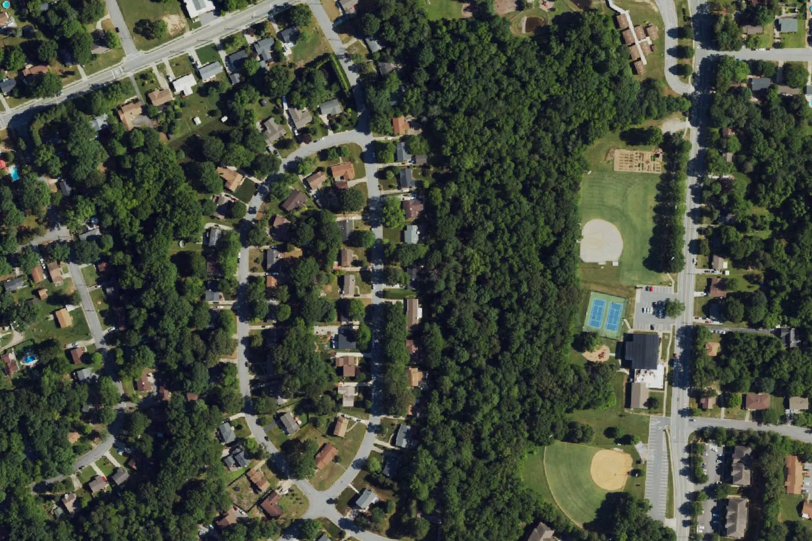
Oakview is north High Point around Oakview Road, James Road and Hartley Drive, mostly in ZIP code 27265, zoned for Oak View Elementary and split between two high schools.
Last checked Oct. 11, 2026. Sources: OpenStreetMap place names and store listings, the City of High Point’s neighborhood associations page, High Point 2045 Comprehensive Plan (PDF) and Oakview Recreation Center page, Guilford County Schools’ School Assignment Locator, the N.C. Department of Public Instruction’s 2025-26 accountability data, Guilford County address points and Zillow Research.
Oakview is a place name OpenStreetMap puts in north High Point, west of North Main Street around Oakview Road, James Road and Hartley Drive. Oak View Elementary, 614 Oakview Road, and the Oakview Recreation Center, 503 James Road, are here, and the Oakview Citizens’ Council is on the city’s neighborhood association list. The stores of North Main Street line its east side. Most addresses are in ZIP code 27265.
What this means for you
- Zoned high school: split between T. Wingate Andrews High, 42.9% of state tests at grade level in 2025-26, and High Point Central High, 44.8%. Check your address with the district’s School Assignment Locator.
- Home value: $302,306 in ZIP code 27265 in August 2026, according to the Zillow Home Value Index.
- Nearest freeway exit: I-74 Exit 67 at Eastchester Drive (NC 68), about 2.1 miles by road.
Part of our High Point neighborhoods guide.
Where it is
This guide covers the streets west of North Main Street from about Hartley Drive north past Oakview Road: James Road, Old Winston Road, Lakecrest Avenue, Rockingham, Rolling and Pine Valley roads, East Peachtree Drive, Moffitt and Welch drives, Avery Avenue and Shadybrook Road. Emerywood is to the south and Oak Hollow to the east, across North Main Street. All 2,388 Guilford County address points in the area are inside the city; 95% carry ZIP code 27265 and the rest 27262.
The city’s High Point 2045 plan names the Hartley Drive and University Parkway area at North Main Street a town center, a commercial district of big-box stores and large parking lots that the plan says could take apartments and mixed-use buildings.
Schools
Oakview is in Guilford County Schools. We placed all 2,388 county address points in the area on the district’s 2026-27 attendance-zone map, the one behind its School Assignment Locator:
- Elementary: 87% Oak View Elementary; 12%, on the west side, Shadybrook Elementary.
- Middle: 73% Welborn Middle; 27% Ferndale Middle.
- High: 55% T. Wingate Andrews High; 45% High Point Central High.
Scores are the share of state tests at grade level or above in 2025-26 and the state’s growth rating, from the accountability data.
| Level | School | At grade level | Growth |
|---|---|---|---|
| Elementary | Oak View Elementary, 614 Oakview Road | 46.8% | Met |
| Elementary | Shadybrook Elementary, 503 Shadybrook Road | 59.5% | Met |
| Middle | Welborn Middle, 1710 McGuinn Drive | 32.8% | Not met |
| Middle | Ferndale Middle, 701 Ferndale Blvd. | 43.3% | Exceeded |
| High | T. Wingate Andrews High, 1920 McGuinn Drive | 42.9% | Met |
| High | High Point Central High, 801 Ferndale Blvd. | 44.8% | Met |
Andrews graduated more than 95% of students in four years and Central 89.7%. More in our schools guide.
Home values
Zillow publishes no figure for Oakview. The Zillow Home Value Index is a modeled typical value for the middle third of homes, not a sale price.
| Area | August 2026 | August 2025 | Change |
|---|---|---|---|
| ZIP code 27265 | $302,306 | $301,564 | +0.2% |
| ZIP code 27262 | $213,070 | $213,516 | -0.2% |
| City of High Point, for comparison | $250,100 | $249,924 | +0.1% |
ZIP code 27265 covers most of north High Point, out past Oak Hollow Lake and the Palladium, so its figure is not Oakview’s alone. Trends are on our home prices page.
Parks and trails
- Oakview Recreation Center and Park, 503 James Road, 336-883-3508: gym, ball field, two lighted tennis courts, picnic shelter, playground and a community garden; open 11 a.m. to 8 p.m. Monday to Thursday, 11 a.m. to 6 p.m. Friday and 9 a.m. to 2 p.m. Saturday, according to the city.
- Hedgecock Park, 300 W. Parris Ave., to the south: playground, youth baseball field, restrooms and the city’s dog park, according to the city’s community parks page.
Oak Hollow Lake’s parks are a short drive east. More in our parks and trails guide.
Getting around
- I-74: Exit 67 at Eastchester Drive (NC 68) is about 2.1 miles by road, and Exit 65 at North Main Street about 2.3 miles.
- Downtown High Point: about 4.4 miles by road to City Hall.
- Piedmont Triad International Airport: about 15 miles by road.
- Buses: High Point Transit’s Route 10, North Main, runs to the Walmart on North Main Street, according to its route schedule.
Distances were measured with the OSRM routing engine on OpenStreetMap roads from a point near Oakview and James roads. They are distances, not drive times. More in our getting around guide.
Groceries and everyday stores
OpenStreetMap lists a Walmart Supercenter, a Food Lion and an ALDI on North Main Street near Hartley Drive, a Target on Mall Loop Road and a Harris Teeter on Eastchester Drive near North Main Street.
Frequently asked questions
Where is Oakview in High Point?
In north High Point, west of North Main Street around Oakview Road, James Road and Hartley Drive. OpenStreetMap marks Oakview as a named place there, and Oak View Elementary and the Oakview Recreation Center are in the area.
What high school is Oakview zoned for?
It depends on the street. On Guilford County Schools’ 2026-27 map, 55% of the county’s address points in the area are zoned for T. Wingate Andrews High and 45% for High Point Central High. Check an address with the district’s locator.
What is the typical home value in Oakview?
Most of the area is in ZIP code 27265, where the Zillow Home Value Index was $302,306 in August 2026, up 0.2% from August 2025.
Where do people in Oakview shop for groceries?
OpenStreetMap lists a Walmart Supercenter, a Food Lion and an ALDI on North Main Street near Hartley Drive, a Target on Mall Loop Road and a Harris Teeter on Eastchester Drive.
Have your say